


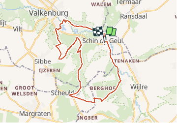
Schin op Geul 16,5km
© OpenStreetMap contributors


--
Difficulty : Unknown


Length
16.5 km
Max alt
172 m
Uphill gradient
284 m
Km-Effort
20 km
Min alt
71 m
Downhill gradient
284 m
Boucle
Yes
Creation date :
2014-12-10 00:00:00.0
Updated on :
2014-12-10 00:00:00.0
--
Difficulty : Unknown
FREE GPS app for hiking
 SityTrail
IGN / Geographical institutes
SityTrail Plus
The world is yours!
About
Trail Walking of 16.5 km to be discovered at Limburg, Unknown, Valkenburg aan de Geul. This trail is proposed by wandelgidszuidlimburg.
Description
More information on : http://www.wandelgidszuidlimburg.com


Positioning
Country:
Netherlands
Region :
Limburg
Department/Province :
Unknown
Municipality :
Valkenburg aan de Geul
Location:
Unknown
Start:(Dec)
Start:(UTM)
702046 ; 5637222 (31U) N.
Comments
Déjà faite avec Cora & Dom en 07/20. Rando coup de 💚, parcours varié. ℹ n° 64